03/17/2011 to 03/18/2011
Time to get away for a few days, and one of our favorite places to go is New Mexico. Yes, AGAIN. Well, it is close and full of great things to see and do.
This trip we headed toward Grants. We booked a cabin at El Morro RV Park and Cabin Rental. Very interesting group. However, the coffee at the restaurant and at the Inscription Rock Trading Post next door, is very good. The folks who run both are very nice and helpful and we highly recommend you stop in to either if you are passing on Highway 53.
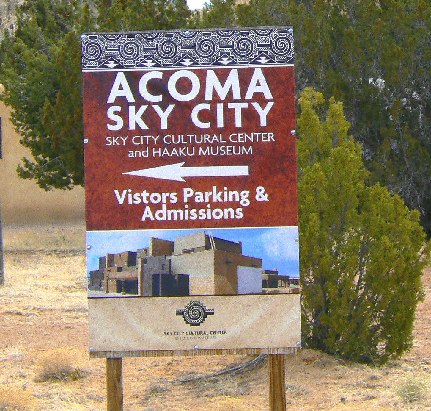
Driving around New Mexico we have often seen signs for Sky City, the Acoma Pueblo, and we decided it was time for a quick trip. The Pueblo was built around 1100 and claims to be the oldest continuously inhabited community and they vehemently dismiss the Taos Pueblo peoples claims. The full time citizens live as their ancestors did with no electricity, plumbing or modern conveniences. However we did see numerous propane heating tanks and several large gas generators. The residents are also allowed to drive their vehicles into the pueblo, unlike Taos.
Our guide was very friendly with a good sense of humor so we thoroughly enjoyed our tour. At the end we were given a choice of riding the bus back down or taking the ancient stairway. We opted for the stairs. Now, these have been improved over the centuries, but you can see the original hand and foot holds that people used to ascend and descend. And the women did it carrying ollos of water on their heads. Geesh

Looking down the central plaza in Acoma Pueblo

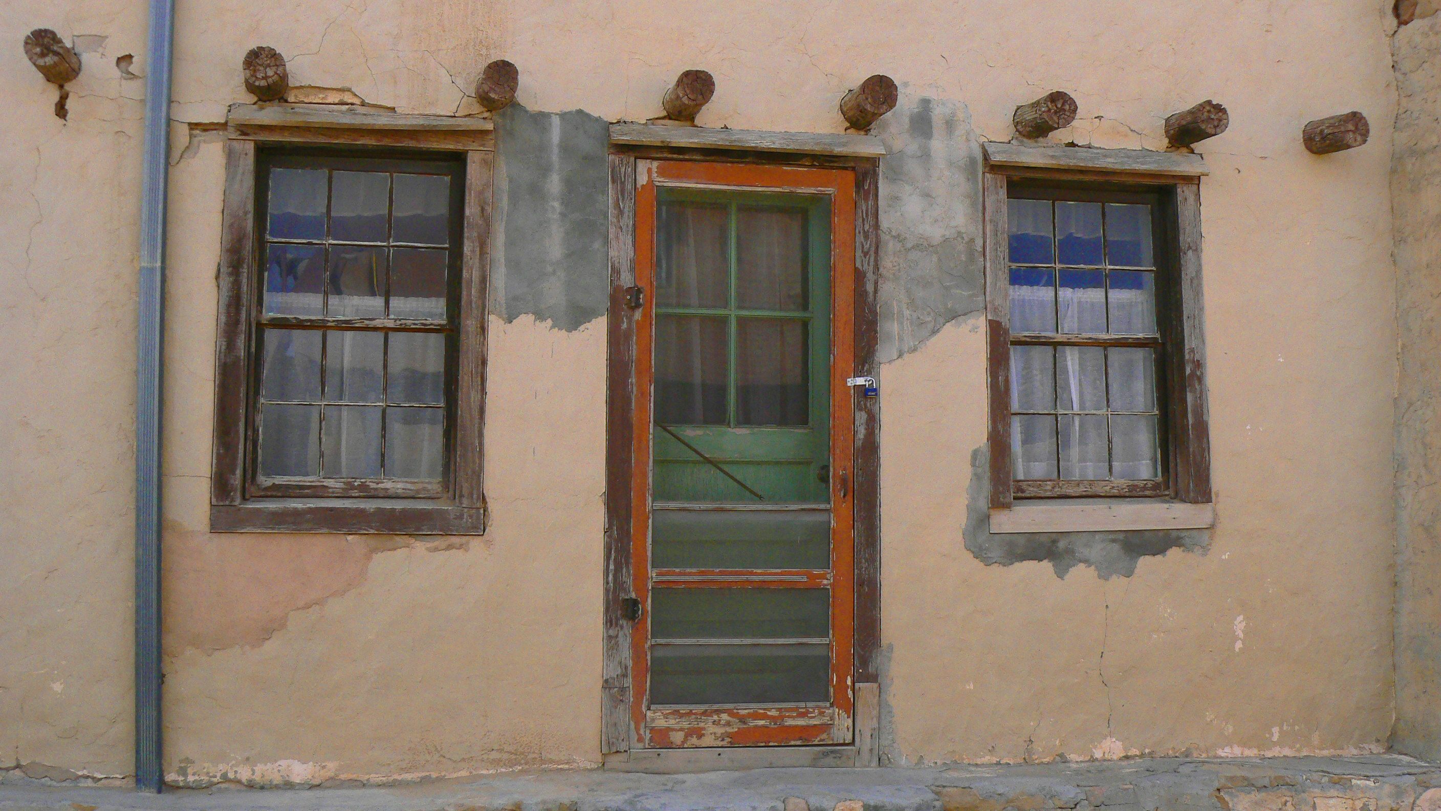
Many different building materials have been used. Obviously no HOA here

These buildings are more adobe brick than stucco

Lots of blue doors and windows to dress up the houses

A work in progress

Some of the two storied homes

More two storied homes. The roofs are used as part of the home still

This is the oldest building in the pueblo. The people are trying various ways to preserve it, but it is not easy

One of the cooking ovens in a plaza area

One of the cisterns in the pueblo that is still used

Lots of ladders

Looking down the street toward the San Esteban Del Rey Mission

The San Esteban Del Rey Mission. Building started in 1630 and built with slave labor. The pueblo residents hauled over 20,000 tons of earth and stone from the valley floor

That is the valley floor. Great view but a long way down

Taking the stairs back down to the valley

Before steps these were the foot holes as well as hand holes

Note that woman below me who is trying to crawl down - not easy

On the valley floor there are Acoma homes both occupied and abandoned. The rock formations are impressive

Looking back up the road to the mesa and the Pueblo on top

Now, imagine bringing all that dirt up to that mesa.
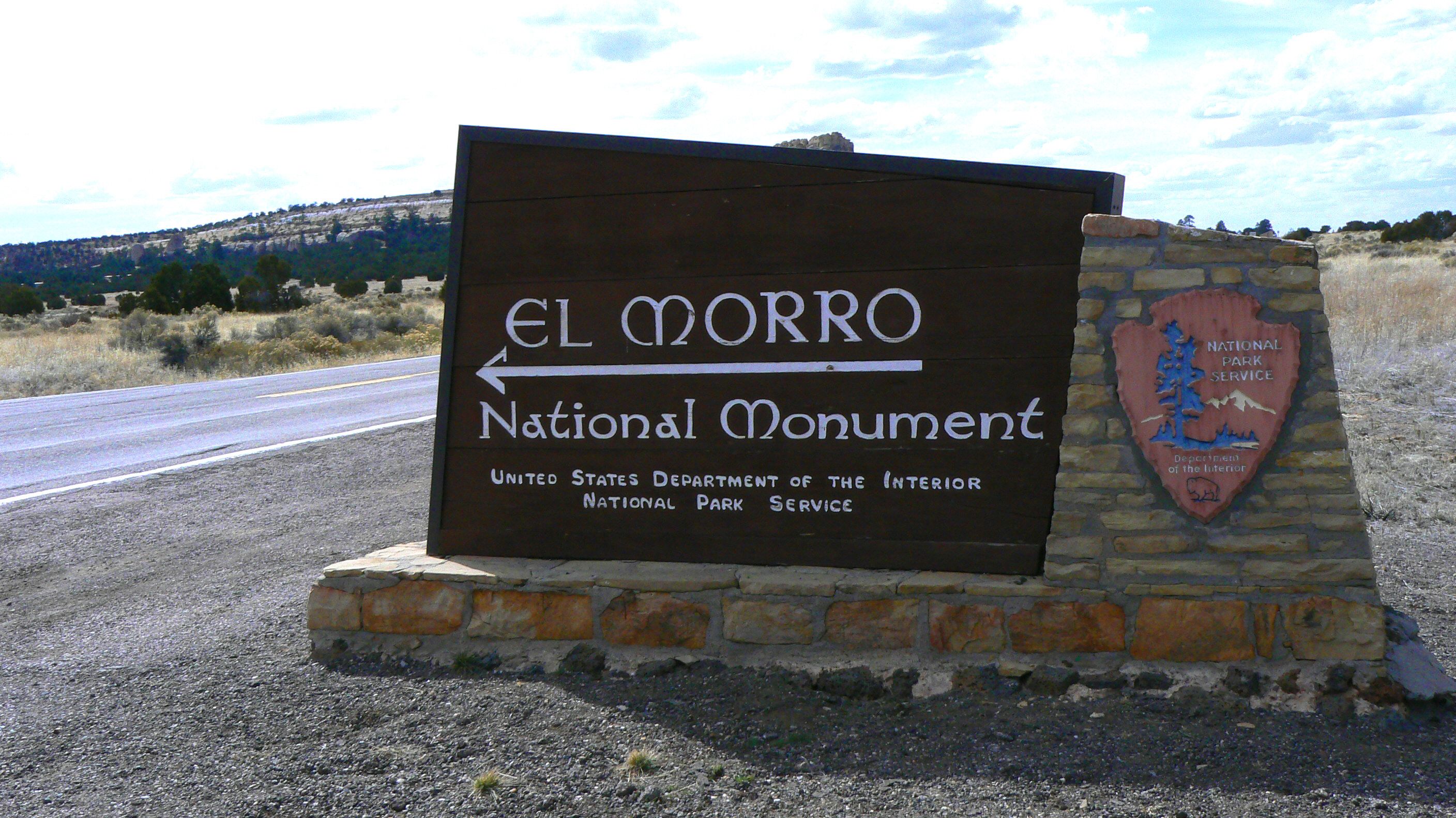
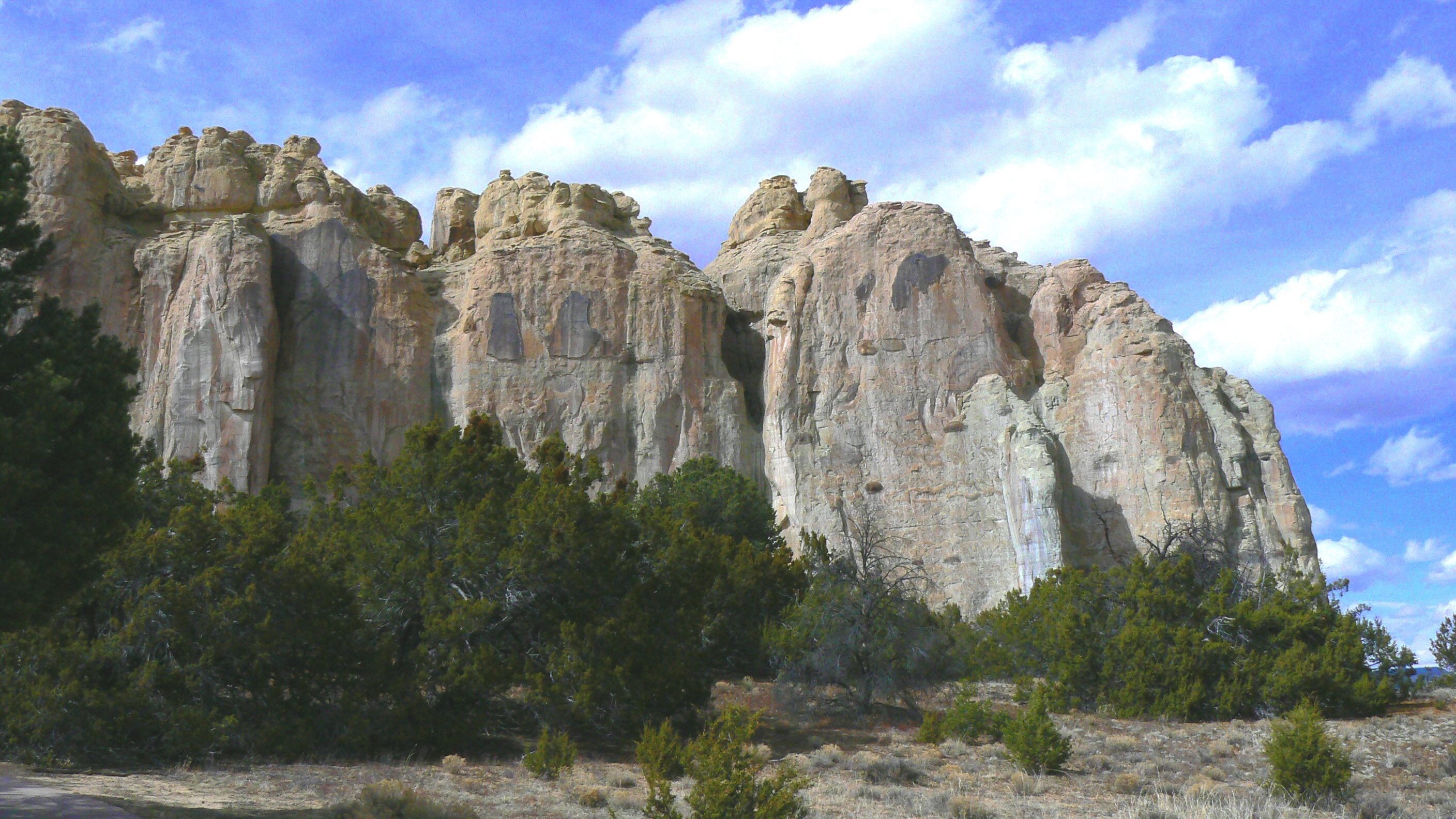
El Morro National Monument was established in 1906 and was one of the first to be so designated. It has two trails, this one is Inscription Trail. Over the centuries native Americans, Spanish and later settlers all left their marks on this sandstone cliff. From petroglyphs to inscribed names of Spanish conquistadors, US Army members and those going west it is all there to enjoy.

A view of the sandstone cliffs as you walk along the start of Inscription Trail

Looking down the Inscription Trail

The first of many carvings. Here is a hand, a river symbol, and more

Sheep petroglyphs

More sheep and what I think is a river

Signs of people now include written names alongside the petroglyphs

P. Gilmore Breckinridge 1959

E. Pen Lange - how he did such beautiful cursive in rock is beyond me

H. Williamson 1858

The first of many Spanish names and inscriptions. The date is 1709

Another Spanish visitor. The Park Service used to highlight these with graphite to help views see them better, but that practice was stopped

This gentleman was a captain in one of the Spanish armies

R. E. Comins 1866

R. H. Orton, 1st California Cavalry 1866

The pool. This was a reliable water source along the route which is why so many people came here
The Headland Trail meanders up the mesa and eventually ties into Inscription Trail - unless that section is closed due to ice and snow as it was today. The trail itself covers many variations in geology and there is not a bad view anywhere.
It will also take you to The Astinna ruins. At one time over 1500 people lived here. A small portion of the settlement was excavated in 1950 but it is possible it was larger than Chaco Canyon.

As you start on the trail you see the sandstone cliffs of Inscription Trail

Starting out it was a bit chilly

George stands out nicely among the white sandstone formations

Stairs. Why is it always stairs

Quite a bit of this trail is on hardened sandstone, so it is marked with lines of stones or grooves

Yeah, great rocks. Striking color contrasts

All that white sandstone is just amazing to see

George is getting a little warmer after climbing all those stairs

Look closely and you can see the grooves marking the way

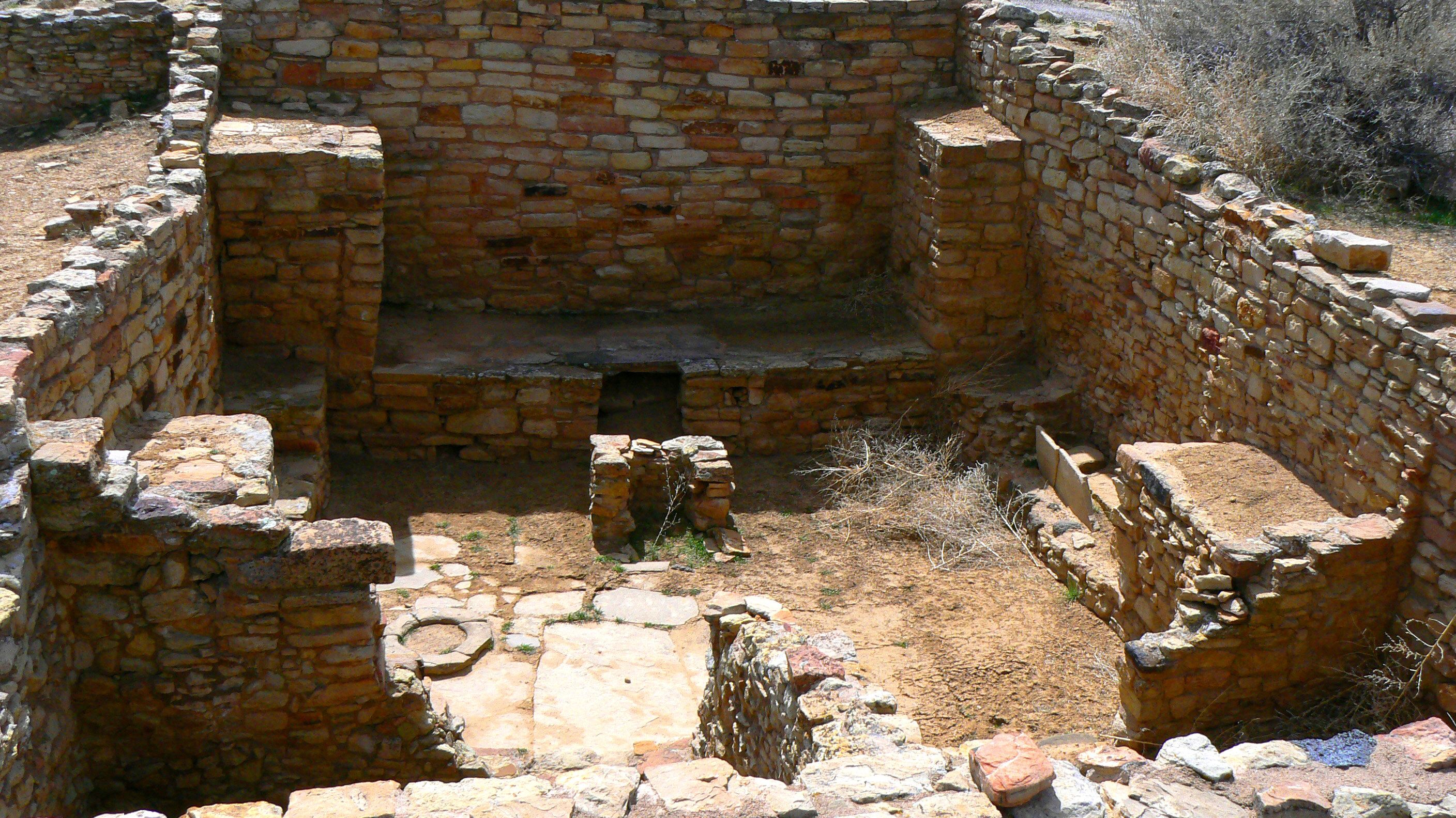
The Astinna Pueblo ruins

Archeologists and Park Rangers are always working to maintain and preserve these rooms

A ceremonial room

Looking out from Atsinna you see the white rock that is the Headland Trail

Pretty curved stairs carved into the rock

Yes, it is a bit warmer up here on the mesa top and walking on the white path

We loved that big white rock sitting among all that brown sandstone

Looking down on Inscription Trail and the pool

Looking across the little valley to the white rock path we just traversed

I called these the twin spires. They reminded us of Spider Rock in Canyon de Chelly

Woman on cliff taking photo of the twin spires in the valley
Our schedule today included hiking up Bond Mesa, which sits just in back of our cabin, doing the Headland Trail in El Morro National Monument, and then going home.
Bond Mesa was once settled by a local family, then it was home to a Ranger Station complete with look-out tower. Now it is abandoned except for lots of critters who leave their footprints but know how important it is to hide.

Bond Mesa

Some formations along the trail up to the top

Looking back down the trail from the top

The old ranger tower and building

Pretty forlorn now

Going up the ranger tower

That is quite a view from inside the old tower room

Lots of tracks around the area

Yup, George is out on the cliff

That is El Morro across the valley

Now my turn on the cliff, and in the background is a gorgeous valley

More great views from atop the mesa

George coming back down the trail